By: Kathi Runge
My name is Kathi, and I am a PhD student at Crowther Lab, using data science to study ecosystem dynamics. More specifically, I use machine learning to create global maps to detect patterns of vegetation instability. Through this I want to understand which places are prone to change (for example from forest biome to a grassland biome) and what implications this has for their resilience. Needless to say, I usually spend entire workdays at my laptop coding, reading and analysing. But this January, I had the opportunity and privilege to leave the black-and-white R-codes on my computer screen behind to work between the lush green trees of the Costa Rican tropical forest. It was an eye-opening experience. Why? Let me walk you through my field notes!
Working in the field: a map come to life
Costa Rica, January 2023 – The scorching midday sun beats down on us from above; only an occasional breeze relieves us temporarily from the heat. It is quiet but for the sound of occasional birds calling in the distance. Armed with fieldwork equipment, we thread through the knee-high grass that is filling the space between patches of oak trees. Here, we are in the midst of the tropical dry forest of the Santa Elena region within the Área de Conservación Guanacaste. I am accompanying Prof. Jennifer Powers and a group of researchers and field technicians from The Powers Lab. This morning we arrived at this savanna-like landscape to understand how the ecosystem is regenerating after a recent fire. Why are some oak patches growing back but others not? Why are some oak trees dying but others not?
Walking into this ecosystem almost feels like exploring a global map generated by one of my computer models. Looking around, familiar research questions came up, and I began to look for patterns and the reasons behind them. Thinking back on my model-generated maps, I asked myself: why do we see trees growing here – and not there? Why does one biome occur here – and not there? Why is this place more prone to changes in vegetation cover than another? Then I realised: the difference is that my random forest model can only approximate reality, while this forest is reality.
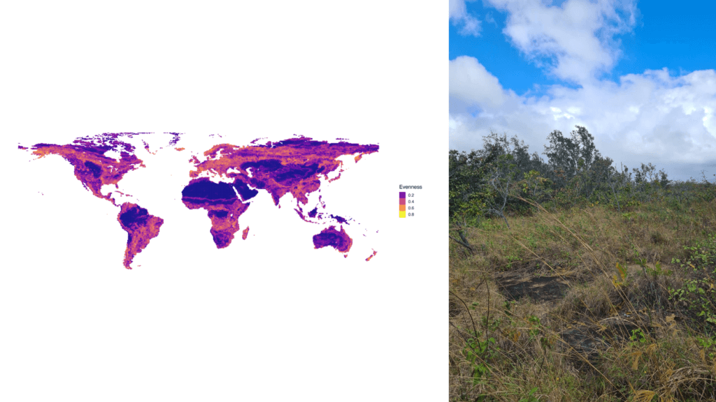
Zooming in from a global map of modelled patterns of instability (left) to the real-world tropical dry forest ecosystem in the Area de Conservación Guanacaste.
Reconnecting to nature
My curiosity for explaining these patterns and the mechanisms causing them is the same. Yet, the experience is a totally different one. From 2-dimensional maps to a 4-dimensional ecosystem, from bird’s-eye-view to a view from within – walking into an ecosystem opens one’s eyes to the details. Here, I could see the site-specific characteristics crystal-clear: signs from past disturbances, each individual plant species, and micro-variations of the soil, such as its texture and humidity.
It is a fascinating sight to me; because all of this becomes blurred at the large scale of the global maps I usually work with. The global maps that I model, representing 510.1 million km² on an 84cm² computer screen, allow me to detect large-scale patterns of vegetation dynamics. But on the maps the individual plant remains invisible to me, as it is aggregated into the coarse-grained categorisation of a biome within 1km² pixels.
This change of perspective was an insightful and stimulating experience. Seeing the ecosystem through the eyes of people who have been walking in and studying that system for ages gave me a deeper understanding of its location-specific features, like the nexus of interactions between plants and their living and non-living environment. It re-connected me to the very ‘object’ that I am studying, and from which I tend to disconnect as I work at my computer screen: nature.
The balance between global modelling and field ecology
Zurich, March 2023 – Two months later, I am back sitting in front of my computer screen and can’t help but contemplate about my experience. As a scientist just at the beginning of her career, I generally think that studies of ecosystems on the global scale provide us with an important context to investigate dynamic processes in plant and animal communities.
Back in the 1980s, the International Geosphere-Biosphere Programme (IGBP) and the emergence of remote sensing facilitated the discipline of ecology to scale up the ‘object’ of ecological research to a degree that far surpassed its disciplinary traditions (Mooney, 1999). Scaling up from a forest to a continent requires a process of abstraction, which may lead to a loss of the very content of ecology. Yet, investigating at this scale is crucial in the face of the enormous pressure that global changes are exerting on natural ecosystems (Pimm et al., 2015). Nevertheless, while interpreting our global data, we should be careful to not detach too much from the ‘localness’ of ecology – it captures the heterogeneity of site-specific conditions and is necessary for corroborating global pattern.
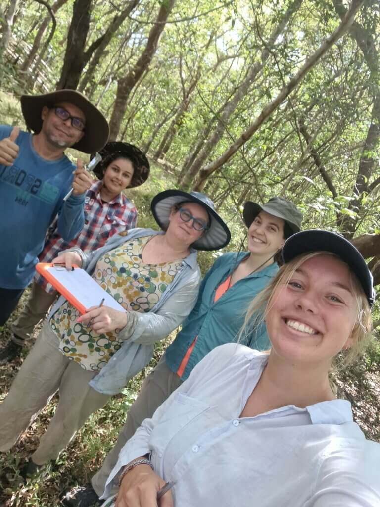
Kathi with Jennifer Powers’ lab
Despite, or exactly because of my focus on global ecosystem ecology, I want to henceforth keep alternating between the above-ground and the on-ground. I want to keep connecting and exchanging knowledge with researchers studying ecosystems on the small-scale to understand those ecological processes invisible to the bird’s-eye-view, but essential for explaining large-scale patterns. Eventually, both perspectives should complement each other to help us gain a better understanding of ecosystem dynamics and how global changes like land-use and climate change affect processes governing the structure and functioning of ecosystems.
To end my contemplative field notes, I would like to mention a quote by R. W. Emerson, who said: “The creation of a thousand forests is in one acorn”. For me, this captures the essence of keeping the small scale in mind when making sense of the large scale. It keeps reminding me to retain the spirit of my fieldwork in Costa Rica in my daily work with global maps here in Zurich.